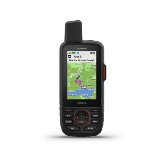
Garmin GPSMAP 66i Handheld & Satellite GPS
010-02088-02
Description
GENERAL
Dimension: 6.6 x 16.3 x 3.5 cm
Display Size: 3.8 x 6.3 cm; 3" diag (7.6 cm)
Display Resolution: 240 x 400 pixels
Display Type: Transflective color TFT
Weight: 241 g
Waterproof: IPX7
MIL-STD-810: Yes (thermal, shock, water)
Battery Type: Rechargeable lithium-ion
Battery Life: Up to 35 hours at 10-minute tracking; up to 200 hours at 30-minute tracking (power save mode)
Interface: high-speed micro USB and NMEA 0183 compatible
Memory/History: 16 GB
MAPS & MEMORY
Preloaded Maps: TopoActive Europe
Ability to add maps (via microSD card)
Basemap
Automatic Routing for outdoor activities (Turn by turn routing on roads)
Map Segments: 15000
Satellite Imagery (Direct to device)
Includes detailed hydrographic features (Coastlines, Lake/River Shorelines, wetlands and perennial and seasonal streams)
Includes searchable points of interest (Parks, Campgrounds, scenic lookouts and picnic sites)
Displays national, state and local parks, forests, and wilderness areas.
Waypoints/Favourites/Locations: 10000
Courses: 250, 200 course points per course
Tracks: 250
Navigation Track Log: 20,000 points, 250 saved gpx tracks, 300 saved fit archives
Navigation Routes: 250
Rinex Logging
SENSORS
High-sensitivity Receiver
GPS
GALILEO
Barometric Altimeter
GPS Compass (While Moving)
Compass (tilt-compensated 3-axis)
DAILY SMART FEATURES
Connect IQ™ (Downloadable Watch Faces, Data Fields, Widgets and Apps)
Smart Notifications
Weather Forecasts
Active Weather
Compatible with Garmin Messenger App
VIRB® Camera Remote
Compatible with Garmin Connect™ Mobile
OUTDOOR RECREATION
Point-to-point Navigation
Tracback®
Area Calculation
Fish Forecast
Sun and Moon Information
Geo-caching Friendly (Paperless)
Custom Maps Compatibility: (500 custom map tiles)
Picture Viewer
LED Beacon Flashlight
CONNECTIONS
Wireless Connectivity: Wi-Fi®, BLUETOOTH®, ANT+®
Features
Condition
- New
Warranty Issuer
- Manufacturer
Reviews
No reviews found
Please sign in so that we can notify you about a reply


